 |
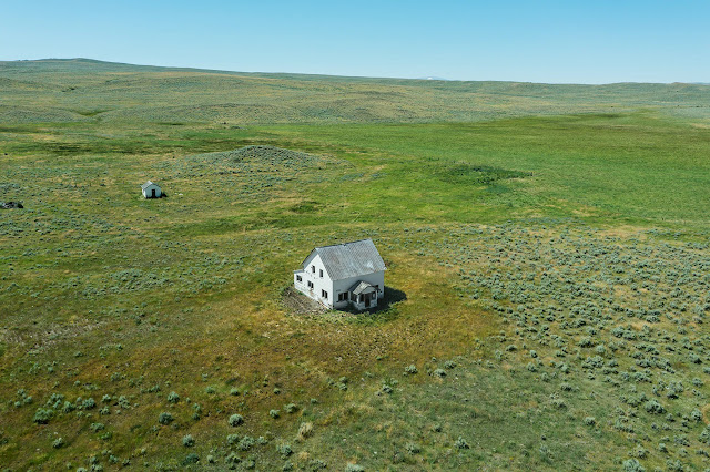
| Photo: © Stephen Shore |
Stephen Shore is widely recognized as an American photographic master of the latter twentieth century- particularly of color photography. And not unlike others who reach such heights of confirmation and affirmation, he chose to go in diversely divergent tangents not wishing to repeat that which he already pioneered and exemplified. And like so many others who choose this route, the aftermath is full of much smaller projects not quite so illustrious...
Topographies: Aerial Surveys of the American Landscape is one formidable project however, filled with handsome landscapes taken from a bird's eye view via drone. Many of the images are stunningly beautiful and each is lavishly reproduced complete with their respective GPS coordinates. Interestingly, while some are very obviously taken from an aerial viewpoint, one could unknowingly mistake others for the photographer just being at a high vantage point. The former tend to be flatter, more abstract, two dimensional compositions, while the latter provide more depth- and a more unique and intimate perspective...
 |
| All Photos: © Stephen Shore |
No comments:
Post a Comment